Nillia Lake Trek (Manalsu Whisper Trail)
$950 per person
The Nillia Lake Trek is a stunning yet lesser-known high-altitude trail located near the Kullu-Manali region of Himachal Pradesh. Tucked deep into the Dhauladhar range, this trek is perfect for adventurers looking to step off the beaten path and immerse themselves in raw Himalayan beauty.
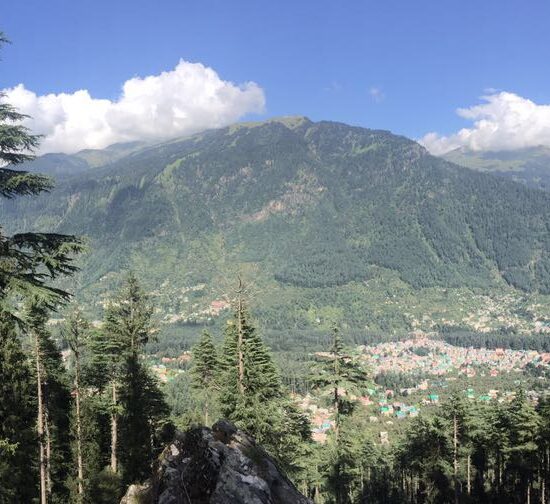
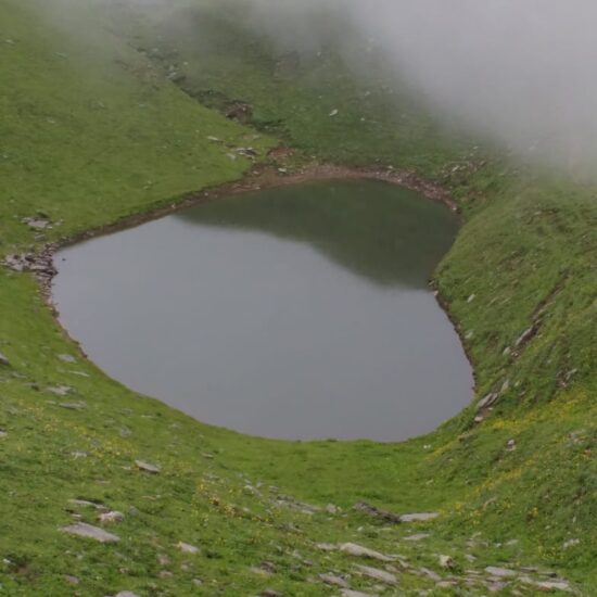
The journey winds through dense deodar and oak forests, scenic alpine meadows, and remote Himachali villages, eventually revealing the tranquil Nillia Lake at an altitude of around 3,900 meters. During summer, the lake reflects snow-dusted peaks and is surrounded by vibrant wildflowers, offering incredible photo opportunities and a serene escape far from crowded routes.
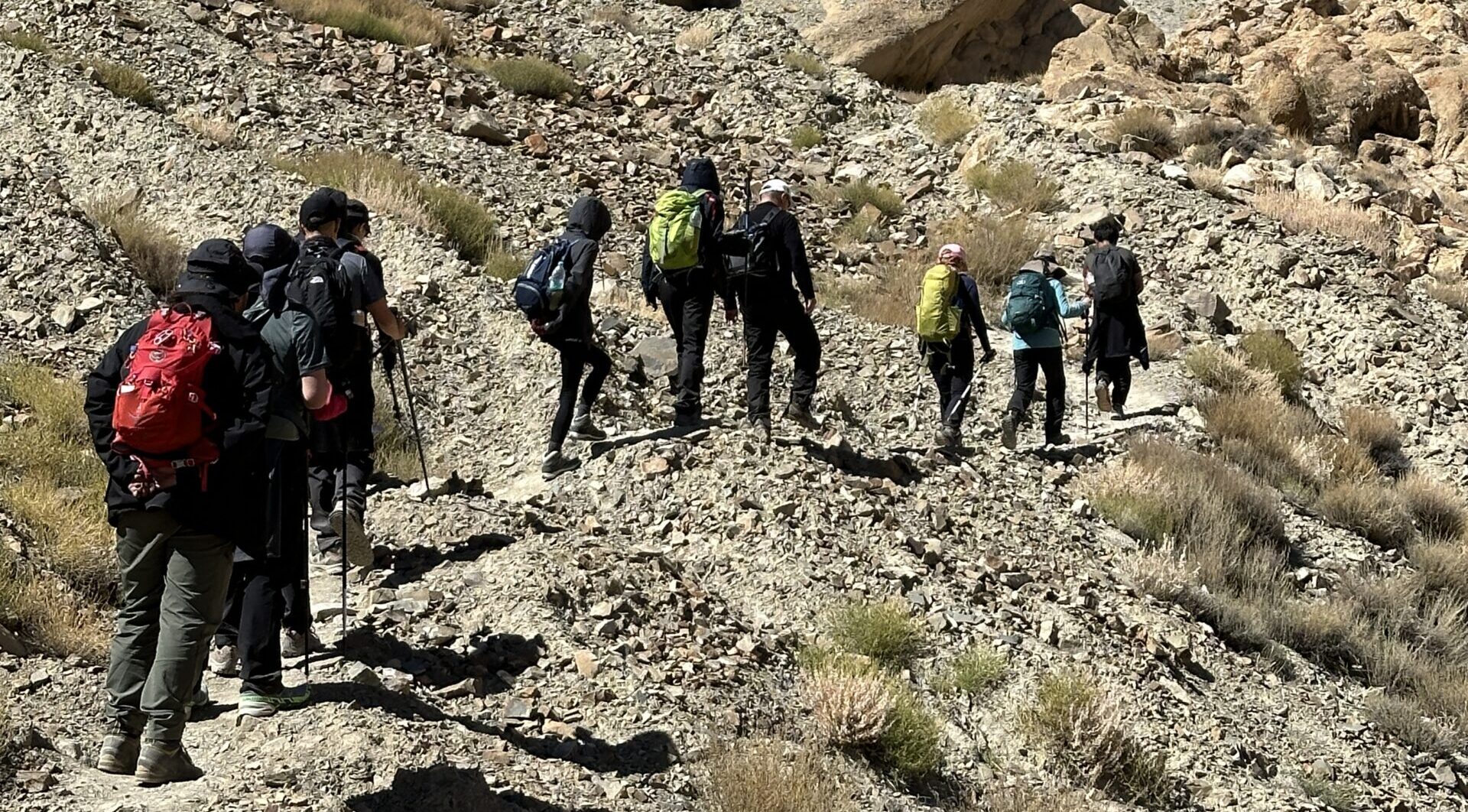
This is not a commercial trail—it’s a wilderness trek that challenges and rewards in equal measure. The trail ascends over rugged terrain, includes high passes over 4,300 meters, and showcases panoramic views of the Pir Panjal and Dhauladhar ranges.
Historically, this route was used by Gaddi shepherds, giving the trek a rich cultural layer as well. If you’re seeking solitude, natural beauty, and cultural depth, the Nillia Lake Trek is an unforgettable Himalayan adventure.
For those interested in similar treks, check out the Kalihani Pass Trek or the Hampta Circle Trek, both of which explore unspoiled parts of Himachal Pradesh.
Details of the trek:
- Region: Kullu Valley, Himachal Pradesh
- Duration: 7 nights / 8 days
- Season: June to September
- Difficulty: Moderately difficult
- Max Altitude: 4,330 m
- Trip Start/End: Old Manali
Highlights
- Wilderness trek through lesser-visited sections of the Dhauladhar Range
- Alpine lakes & meadows with 360° views including Pir Panjal and Dhauladhar Ranges
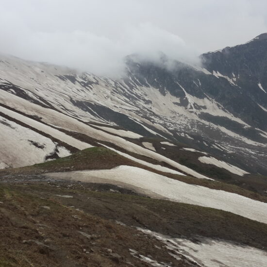
- High passes (4,310 m) and rugged terrain featuring snow patches and scree slopes
- Cultural touch: remote trail used historically by Gaddi shepherds
-
Destination
Day 01: Arrival in Delhi – Airport Pick-up & Hotel Stay in Delhi
Stay: 4/5 star Hotel in Delhi. Altitude: 216m
Day 02: Arrive at Bhuntar Airport
- Meet & Greet: Our representative will receive you at Bhuntar Airport.
- Transfer to Manali (Distance: 50 km / 1.5-2 hours)
-
- Scenic drive along the Beas River.
- Check-in to pre-booked hotel in Manali.
- Light meals recommended.
- Relax and let your body adjust to the mountain air.
- Avoid strenuous activity on Day 1.
- Tour orientation:
-
- Safety protocols
- Route overview
- Emergency & backup plans
- Document verification
Day 03: Manali (2,050 m) → Shangcher Village (2,700 m) → Maili Thach (3,500 m)
Manali to Shangcher
- Distance: 15 km by road
- Time: 1.5 hours by Jeep
- Route: Manali → Shangcher
- The drive climbs through deodar forests and apple orchards, with scenic views of the Beas valley.
Shangcher to Maili Thach
- Distance: 7–8 km
- Ascent: 800 m gain
- Time: 4–5 hours
- Trail Type: Moderate ascent through forest trails, clearings, and alpine meadows.
Trail Highlights:
- Begins with a steep forest climb - cedar, oak, and pine forests.
- Opens into lush meadows, often used by local shepherds (Gaddis).
- As you climb, views open up of the Pir Panjal range and peaks like Hanuman Tibba.
- Trail passes streams and grazing lands, occasionally frequented by mountain goats.
- Maili Thach is a beautiful high meadow, ideal for your first campsite, surrounded by snow-capped peaks and flowers in bloom (in June–July).
Camp in Maili Thach:
- Water Source: Stream nearby
- Conditions: Windy in evening; temperature can drop to 2–5°C at night
- Accommodation: Tent camping
- Sunset views: Often spectacular, especially on clear days
Day 04: Maili Thach → Rani Sui Lake (3,800 m)
- Distance: 6–7 km
- Altitude Gain: 300 m
- Trek Duration: 4–5 hours
- Difficulty: Easy to Moderate
- Trail Type: Gradual ridge ascent with occasional steep sections
- The trail begins with a gentle climb through grassy meadows, often scattered with wild Himalayan flowers in summer.
- After 1–1.5 hours, the landscape becomes more open and panoramic, offering stunning views of:
- Hanuman Tibba
- Deo Tibba
- Indrasan
- Dhauladhar and Pir Panjal ranges on clear days
- You traverse boulder-strewn ridgelines and occasional patches of snow (early season).
- The final stretch involves a short, slightly steeper climb to the lake basin.
- A high-altitude alpine lake, also known as Saurkundi Lake in some older maps
- Reflects surrounding peaks in its clear blue-green water
- Very peaceful and isolated – no habitation, few trekkers
- Used by Gaddi shepherds as a watering spot in summer
- Camp is typically pitched a short distance from the lake on a flat grassy patch
- Water Source: Lake and small nearby streams
- Temperature: Can drop to 0–2°C at night in June–July
- Mobile Network: Not available beyond Maili Thach
- Mesmerizing sunset views over Kullu valley
- Rarely visited lake — perfect for solitude and reflection
- High chance of seeing eagles, marmots, or blue sheep in surrounding ridges
Day 05: Rani Sui Lake (3,800 m) → Odi Pass (4,310 m) → Dohrni (3,800 m)
Trek Details
- Distance: 9–10 km
- Time: 6–7 hours
- Ascent to Odi Pass: 510 m gain
- Descent to Dohrni: 500 m loss
- Difficulty: Moderate to Difficult (especially around the pass)
- Trail Type: Boulder fields, alpine ridges, snow patches (early season), gradual descent post-pass
Rani Sui Lake → Odi Pass (4,310 m)
- Start early to avoid wind or bad weather near the pass.
- The trail gradually ascends across open alpine meadows and scree slopes.
- As you gain altitude, you walk along ridgelines with breathtaking panoramic views:
- Pir Panjal range behind you
- Upper Manalsu valley below
- Occasional snow patches (June) and moraine fields
- Odi Pass is a high saddle between rocky ridges and marks the gateway to the more remote Manalsu side of the trek.
Odi Pass → Dohrni (3,800 m)
- After the pass, the trail descends steeply through boulders and alpine slopes.
- Views open up of the Deo Tibba massif and glacial valleys
- The route levels out into open grassland near the river, where Dohrni campsite is situated.
- You may cross glacial streams or snow bridges depending on the season.
Dohrni Campsite
- A scenic camp by the Manalsu River, surrounded by high peaks and meadows
- Frequently used by shepherds (Gaddis) — expect encounters with sheep and goats
- Water Source: Streams fed by snowmelt
- Temperature: Drops to 0°C at night
- Excellent stargazing on clear nights
Day 06: Dohrni → Seri (3,800 m)
Trail Description
- Start from Dohrni, a high meadow campsite surrounded by rocky ridges and scattered boulders.
- The trail ascends gradually along the Tainta Nala, following the glacial stream as you gain altitude.
- You’ll pass through stretches of open pasture, with occasional rhododendrons and dwarf junipers.
- As you approach Seri, the valley widens into a vast alpine meadow — a former glacial lake bed surrounded by tall peaks.
- Cross a few glacial streams (usually manageable without a bridge).
- Seri (3,800 m) is a stunning campsite, framed by Deo Tibba (6,001 m) to the east and Tainta Peak on the opposite side.
Campsite at Seri
- Broad grassy flatland, ideal for tents
- Abundant water from streams
- Incredible views of Deo Tibba, Norbu Peak, and glacial formations
- Marmots and Himalayan birds often seen around the campsite
- Expect cold nights (2°C to -2°C depending on the season)
Highlights
- Entering true alpine zone, above the tree line
- Pristine meadows & dramatic mountain backdrops
- Sunset over Deo Tibba
- Great place for star-gazing due to clear skies and low light pollution
Day 07: Seri (3800 m) → Nillia Lake (4000 m) → Return to Seri
- Start from Seri early in the morning, heading north/northwest along a shepherd trail that climbs gradually.
- The terrain includes:
- Alpine ridgelines
- Occasional bouldery and glacial moraine zones
- Meadows and wildflowers (June–Oct)
- After 3 hours, reach the Nillia Lake, nestled in a shallow alpine basin just below a ridgeline — often partially frozen early in the season.
- Spend time at the lake; it’s serene, remote, and rarely visited — with outstanding views of surrounding peaks like Ali Ratni Tibba, Indrasan, and upper Hampta Valley.
- Retrace your route back to Seri, carefully navigating rocky sections.
- Nillia Lake is a true hidden gem, perched above the Deo Tibba valley system.
- This stretch is not part of the commercial Deo Tibba trek and offers solitude.
- Ideal acclimatization hike before heading to Tainta or Deo Tibba Glacier.
Day 08: Seri → Dohrni
Same way we came before.
Day 09: Dohrni → Lamadugh(2980m)
- Start: Dohrni (3,400 m)
- End: Lamadugh (2,980 m)
- Duration: 5–6 hours
- Distance: 9–10 km
- Difficulty: Moderate
- Highlights: Alpine meadows, forests, panoramic views of Dhauladhar & Pir Panjal ranges.
- Dohrni to Alpine Ridge (1.5–2 hrs):
- The day begins with a steady ascent out of Dohrni through open meadows.
- You’ll pass above the tree line initially, with magnificent views of peaks like Deo Tibba, Indrasan, and Hanuman Tibba.
- Gradually, you enter mixed terrain of alpine shrubland and dwarf rhododendrons.
- Alpine Ridge to Oak-Fir Forest Descent (1.5–2 hrs):
- The trail now begins descending gradually into dense coniferous forests.
- Expect a cooler atmosphere as you re-enter the tree line.
- Occasional clearings provide photogenic valley views.
- Forest to Lamadugh (1.5 hrs):
- The last stretch winds through tall deodar, pine, and maple forests.
- You’ll finally arrive at Lamadugh meadow, a beautiful campsite with a forest clearing and amazing sunset views over the Kullu Valley.
- A classic campsite with lush green pastures.
- Water source nearby (spring-fed stream).
- Mobile network available occasionally due to proximity to Manali ridge.
Day 10: Lamadugh (2,980 m) → Manali (2,050 m)
- Distance: 7–8 km
- Duration: 3–4 hours
- Descent: 930 m
- Difficulty: Easy to Moderate
- Trail Type: Continuous descent through forest and ridge paths
- Ending Point: Near Hadimba Devi Temple, Manali
- Lamadugh Meadow to Forest Ridge (45 mins – 1 hr):
- Begin with a gentle walk through open meadow.
- Soon enter dense oak, deodar, and pine forests.
- The path is well-trodden and shaded, offering occasional views of Manali town below.
- Forest Ridge to Viewpoint (1 hr):
- Slightly steeper descent with some switchbacks.
- A viewpoint opens up with vistas of Kullu Valley, Beas River, and Rohtang Pass ridgeline in the distance.
- Viewpoint to Hadimba Temple (1–1.5 hrs):
- Final descent through a wide forest trail.
- You'll emerge near Hadimba Devi Temple, just above Old Manali.
Day 11: Buffer / Reserve / Departure Day
- Certificate
- Party
- End of tour
Leave a Reply
- High-quality alpine tents (twin sharing basis)
- Season-rated sleeping bags and insulated sleeping mats
- All essential camping gear provided and set up by our team
- All meals included: Nutritious vegetarian breakfast, packed lunch, evening tea/snacks, and hot dinner
- Boiled or filtered drinking water provided daily
- Experienced trek leader and certified mountain guide
- Skilled cook and kitchen team
- Camp helpers and porters/mules for luggage and equipment transport
- Pick-up and drop-off as per the trek itinerary (from base location)
- Comprehensive first-aid kit with basic high-altitude medications
- Oxygen cylinder available for emergency use (on high-altitude treks)
- Participants need only carry a light daypack with essentials (water bottle, snacks, jacket)
- Main backpack/duffel (up to 10 kg) will be carried by porters/mules
- Travel & Rescue Insurance: All participants are required to carry personal travel and emergency evacuation insurance
- Personal Expenses: Expenses such as phone calls, laundry, bar bills, battery charging, and additional porters/horses if required.
- Unexpected Costs: Any expenses arising due to unforeseen circumstances beyond the itinerary (e.g., weather delays, route changes, natural calamities).
- Town-Based Costs: Any meals, drinks, or accommodation outside the trekking route (in towns or cities) are not included.
- Gratuities: Tips for trekking staff, guides, and support crew are not included (though appreciated).
- Anything Not Mentioned Above: Any services or items not explicitly listed under “Inclusions” are to be considered additional.


