Pin Parvati Pass Trek(Sacred to Silent)
$1870 per person
Pin Parvati Pass Trek – A High-Altitude Adventure from Kullu to Spiti
The Pin Parvati Pass Trek is one of the most challenging and scenic high-altitude treks in Himachal Pradesh. Connecting the lush greenery of the Parvati Valley in Kullu with the stark, cold desert of Pin Valley in Spiti, this trek offers a thrilling trans-Himalayan journey. Standing at an altitude of 5,319 meters, the pass provides a dramatic contrast of landscapes—from vibrant alpine meadows and dense forests to barren, windswept valleys.
Spanning roughly 110 km over 10-12 days, the Pin Parvati Pass Trek is perfect for seasoned trekkers seeking adventure, solitude, and diversity in terrain. Along the way, trekkers encounter glacial rivers, sacred lakes, ancient villages, and breathtaking views of the Himalayas. The best time to undertake this trek is between July and September, when the weather is relatively stable.
Historically, the first recorded crossing of the Pin Parvati Pass was made by Sir Louis Dane in 1884. As a British administrator and explorer, he played a crucial role in mapping this remote region. His expedition opened up a vital route between Kullu and Spiti—one that remains remote and rarely traveled even today.
Despite growing in popularity, the Pin Parvati Pass Trek retains its raw and untamed charm. Glacier crossings, high-altitude acclimatization, and unpredictable weather conditions make it a serious undertaking. However, for those ready to face the challenge, the rewards are immense.
Trek Details:
Starting Point: Barshaini (Kullu)
Ending Point: Mudh Village (Spiti)
Duration: 13 Days
Distance: 110 km
Maximum Altitude: 5,319 m
Difficulty Level: Difficult
Best Time to Visit: July to September
Highlights of the Pin Parvati Pass Trek:
High-Altitude Crossover: From lush forests of Parvati Valley to the barren cold deserts of Pin Valley.
Pin Parvati Pass (5,319m): Jaw-dropping views of snow-laden Himalayan peaks.
Diverse Landscapes: Forests, meadows, rivers, waterfalls, and stark desert terrain.
Mantalai Lake: Sacred glacial lake and source of the Parvati River.
Flora & Fauna: Spot Himalayan wildlife and rare alpine plants.
Cultural Contrast: Hindu temples in Parvati Valley vs. Buddhist monasteries in Spiti.
Remote Villages: End the trek in Mudh, a scenic, remote Spitian hamlet.
Hot Springs at Kheerganga: Perfect relaxation either before or after your trek.
Solitude and Serenity: Less-crowded, raw, and untamed trekking route.
Adventure: Demanding trails, river crossings, and glacier walks test your endurance.
-
Destination
Day 01: Arrival in Delhi – Airport Pick-up & Hotel Stay in Delhi
Stay: 4/5 star hotel in Delhi Altitude: 216m
Day 02: Arrive at Bhuntar Airport
- Meet & Greet: Our representative will receive you at Bhuntar Airport.
- Transfer to Manali (Distance: 50 km / 1.5-2 hours)
-
- Scenic drive along the Beas River.
- Check-in to pre-booked hotel in Manali.
- Light meals recommended.
- Relax and let your body adjust to the mountain air.
- Avoid strenuous activity on Day 1.
- Tour orientation:
-
- Safety protocols
- Route overview
- Emergency & backup plans
- Document verification
Day 03: Manali(2050m) to Barshaini → Trek to Kalga (2,300 m)
- Distance (Manali to Barshaini): 100 km
- Time by road:5–5.5 hours
- Drive route: Manali → Bhuntar → Jari → Kasol → Manikaran → Barshaini
- Distance:5 km
- Duration: 30–45 minutes
- Trail: Easy forest trail; well-marked with gradual incline
- Notes: Avoid crossing the bridge to Tosh side. Take the upper left trail towards Kalga.
Day 04: Kalga to Kheerganga(2960m)
- Most popular and shaded trail
- Passes through thick pine forest, waterfalls, wooden bridges
- Safe even in rain and good for beginners
- Joins from the other side of the Parvati river
- Less scenic and more open
Day 05: Kheerganga to Tundabhuj(3285m)
- Distance: 12 km
- Trek Duration: 5–6 hours
- Altitude Gain: 325 m
- Trail Type: Gradual ascent with some ups & downs
- Difficulty: Moderate
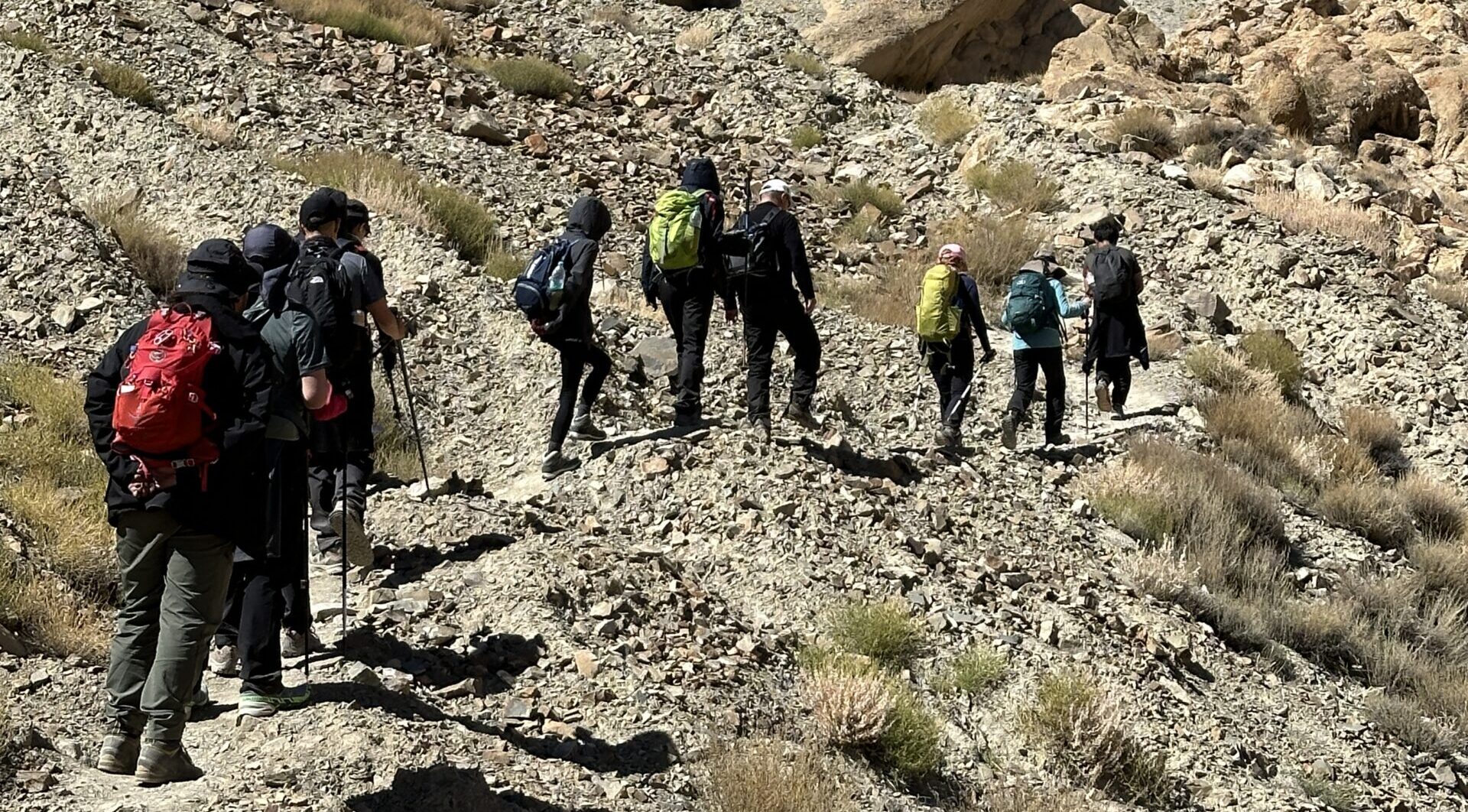
- The trail starts from the Kheerganga campsite, ascending through dense oak and birch forests.
- You’ll pass gushing streams, wooden bridges, and small clearings.
- Midway, the forest gives way to open alpine meadows, and the views of high Himalayan ridgelines start to open up.
- Expect some narrow sections, a few stream crossings, and patches of slippery mud if it has rained.
- Located in a beautiful grassy bowl surrounded by rocky cliffs and wildflowers
- Great views of the Parvati valley ridgelines
- Basic campsite area, often used by herders and shepherds
- Camp setup will be on meadows with access to fresh water
Day 06: Tundabhuj to Thakur Kuan(3560m)
- Distance: 12 km
- Time: 5–6 hours
- Altitude Gain: 275 m
- Difficulty: Moderate
- The trek begins with a gradual ascent through lush green meadows, birch and oak forests, and several narrow rocky paths.
- You will cross multiple small streams, some with wooden or log bridges.
- The landscape becomes more open and alpine, with glimpses of snow-capped peaks and the Parvati River running below.
- There are a few boulder patches and landslide-prone zones, so watch your footing.
- Near the end, you’ll encounter a larger river crossing and some tricky terrain before you reach the Thakur Kuan campsite.
- Located in a wide alpine pasture beside the Parvati River
- Used by local shepherds and trekking groups
- Clean water from nearby stream, enough space for tents
- Offers clear sky views at night and grazing horses or sheep in season
Flora & Fauna
- Rhododendrons, wild herbs, meadows of Himalayan flowers
- Occasional herds of Bharal (blue sheep) and flocks of Himalayan birds
Day 07: Thakur Kuan to Odi Thach(3800m)
- Distance: 10–11 km
- Duration: 5–6 hours
- Altitude Gain: 240 m
- Difficulty: Moderate to Challenging (due to boulders and river crossings)
- Terrain Type: Boulder fields, river crossings, grassland
Trail Description
- The trail starts with a gentle ascent, moving alongside the Parvati River.
- After a short while, the terrain turns into boulders and rocky outcrops, requiring careful footing.
Pandu Pul I & II (Rock Bridges)
- Pandu Pul I: A massive boulder acting as a natural bridge over a roaring stream.
- Pandu Pul II: Slightly trickier and narrower, again a rock bridge over a powerful stream.
- These legendary rock formations are believed to have been placed by the Pandavas during their exile (hence the name).
- You'll need to climb across the top of these rock bridges with full focus. In rainy or wet weather, the rocks can be slippery.
- After these crossings, the trail enters a broad open valley lined with flowers, grass, and snow peaks on both sides.
- Situated in a flat alpine meadow, surrounded by granite cliffs and snowy peaks.
- Near the river, with great access to clean water.
- Peaceful grazing land often used by Gujjar or Gaddi shepherds.
- You'll likely camp here with spectacular views, marking your final night before reaching Mantalai Lake.
Day 08: Odi Thach to Mantalai(4100m)
- Distance: 12 km
- Duration: 6–7 hours
- Altitude Gain: 300 m
- Difficulty: Moderate to Difficult
Trail Description
- The trail begins along the Parvati River, with a gentle start through meadowlands, eventually turning into moraines and rocky terrain.
- The vegetation thins out as you gain altitude, and the landscape becomes more barren, glacial, and rugged.
- You’ll cross glacial meltwater streams, boulder patches, and loose moraine fields.
- A slow, steady ascent is essential due to the rise in altitude and lower oxygen levels.
Mantalai Lake (4,100 m)
- Considered the source of the Parvati River, formed by glacial melt
- A sacred site with small shrines, prayer flags, and stone offerings
- Set in a raw alpine amphitheatre of snow-capped peaks, with floating ice chunks sometimes visible in the lake
Day 09: Mantalai to Parvati Base (4500m)
- Distance: 8–9 km
- Trek Time: 4–5 hours
- Altitude Gain: 400 m
- Trek Difficulty: Moderate to Difficult (due to steepness and altitude)
- Terrain Type: Loose moraine, scree slopes, glacial deposits
- The trail starts near Mantalai Lake, with an immediate ascent over rocky slopes and scree.
- The route is poorly marked and can be confusing without a guide or GPS - cairns (stone markers) help.
- You gradually leave the lake basin behind and climb into a barren glacial valley, with steep switchbacks and moraine ridges.
- At places, the trail becomes a narrow path cut into scree slopes, requiring good balance and focus.
- Snowfields may appear even in late summer (especially post-monsoon).
- Located on a glacial moraine shelf just before the final climb to Pin Parvati Pass
- Offers clear views of the pass saddle, icy peaks, and surrounding glacier
- Completely barren and exposed, with rocky camping ground
- Temperature drops to sub-zero at night
Day 10: Parvati Base to Tiya(3700m) over Pin Parvati Pass(5319m)
- High Point: Pin Parvati Pass (5,319 m)
- End Point: Tiya Campsite (3,700 m)
- Total Distance: 16–18 km
- Trek Duration: 9–10 hours
- Altitude Gain: 820 m up and 1,600 m descent
- Terrain: Glacier, snow, scree, boulders, and moraine
- Difficulty: Very Difficult
- Weather: Highly unpredictable — snowstorms, whiteouts, and high winds possible
Parvati Base → Pin Parvati Pass
- Early start (4:00–5:00 AM) is critical for crossing before weather turns
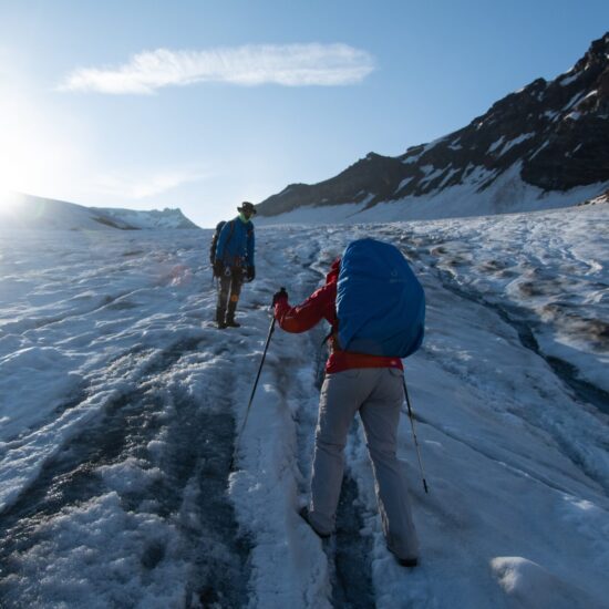
- Begins with a steep glacial ascent: snow patches, icy sections, and scree
- Use crampons/microspikes if snow is hard or icy
- Final 1–2 hours before the pass involves a steep push on snow and loose rocks
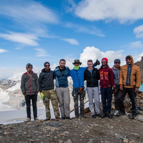
- The top of the pass offers incredible views of:
- Parvati Valley (green and forested side)
- Pin Valley (deserted, cold, and dramatic)
- Prayer flags, cairns, and a narrow saddle mark the top
- Snow may remain until late season — caution required
- Keep left to avoid dangerous glacial crevasses
- The trail gradually opens up into the wide, cold desert valley of Pin
- Camp is set up near Tiya, a grassy patch beside the stream
Day 11: Tiya to Mudh(3810m)
- Distance: 10–12 km
- Trek Duration: 4–5 hours
- Net Altitude Change: +110 m (but relatively flat)
- Difficulty: Easy to Moderate
- Terrain: Wide trail, rocky paths, dry riverbeds, and gradual slopes
- Water Source: Stream access along the trail
- Mobile Network: Likely BSNL/Jio signal near Mudh
- The trail from Tiya gradually descends into the open Pin Valley, surrounded by colorful layered mountains, very typical of Spiti’s cold desert.
- You’ll cross:
- A wooden bridge (or makeshift log crossing) over the Pin River
- Long barren stretches with a wide and dusty trail
- After about 2 hours, you start to see mud-brick homes and the distinctive white-and-red buildings of Mudh.
- A small, beautiful hamlet with traditional Spitian homes, monastery, and terraced fields
- Known as the exit point for Pin Parvati and entry for Pin Valley National Park
- You’ll find:
- Homestays & guesthouses
- Local cafes serving Spitian thalis, momos, butter tea
Day 12: Mud to Manali or trip in Spiti Valley
Day 13: Buffer / Reserve / Departure Day
- Certificate
- Party
- End of tour
Leave a Reply
- High-quality alpine tents (twin sharing basis)
- Season-rated sleeping bags and insulated sleeping mats
- All essential camping gear provided and set up by our team
- All meals included: Nutritious vegetarian breakfast, packed lunch, evening tea/snacks, and hot dinner
- Boiled or filtered drinking water provided daily
- Experienced trek leader and certified mountain guide
- Skilled cook and kitchen team
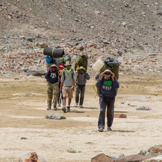
- Camp helpers and porters/mules for luggage and equipment transport
- Pick-up and drop-off as per the trek itinerary (from base location)
- Comprehensive first-aid kit with basic high-altitude medications
- Oxygen cylinder available for emergency use (on high-altitude treks)
- Participants need only carry a light daypack with essentials (water bottle, snacks, jacket)
- Main backpack/duffel (up to 10 kg) will be carried by porters/mules
- Travel & Rescue Insurance: All participants are required to carry personal travel and emergency evacuation insurance
- Personal Expenses: Expenses such as phone calls, laundry, bar bills, battery charging, and additional porters/horses if required.
- Unexpected Costs: Any expenses arising due to unforeseen circumstances beyond the itinerary (e.g., weather delays, route changes, natural calamities).
- Town-Based Costs: Any meals, drinks, or accommodation outside the trekking route (in towns or cities) are not included.
- Gratuities: Tips for trekking staff, guides, and support crew are not included (though appreciated).
- Anything Not Mentioned Above: Any services or items not explicitly listed under “Inclusions” are to be considered additional.


